Steven Wright’s “life size map” joke is a lot older than I thought:
On Exactitude in Science
Jorge Luis Borges, Collected Fictions, translated by Andrew Hurley.
…In that Empire, the Art of Cartography attained such Perfection that the map of a single Province occupied the entirety of a City, and the map of the Empire, the entirety of a Province. In time, those Unconscionable Maps no longer satisfied, and the Cartographers Guilds struck a Map of the Empire whose size was that of the Empire, and which coincided point for point with it. The following Generations, who were not so fond of the Study of Cartography as their Forebears had been, saw that that vast Map was Useless, and not without some Pitilessness was it, that they delivered it up to the Inclemencies of Sun and Winters. In the Deserts of the West, still today, there are Tattered Ruins of that Map, inhabited by Animals and Beggars; in all the Land there is no other Relic of the Disciplines of Geography.
—Suarez Miranda,Viajes de varones prudentes, Libro IV,Cap. XLV, Lerida, 1658
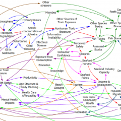
It’s no less relevant to big models, though.
h/t Benjamin Blonder

If I remember correctly, Gulliver’s Travels (1726) has that joke, too.
Hey – you’re right! Not quite 1:1 though:
To satisfy my curious reader, it may be sufficient to describe Lorbrulgrud. This city stands upon almost two equal parts, on each side the river that passes through. It contains above eighty thousand houses, and about six hundred thousand inhabitants. It is in length three glomglungs (which make about fifty-four English miles,) and two and a half in breadth; as I measured it myself in the royal map made by the king’s order, which was laid on the ground on purpose for me, and extended a hundred feet: I paced the diameter and circumference several times barefoot, and, computing by the scale, measured it pretty exactly.
http://www.gutenberg.org/files/829/829-h/829-h.htm
Lewis Carrol also borrowed the idea in Sylvie & Bruno:
“And then came the grandest idea of all! We actually made a map of the country, on the scale of a mile to the mile!”
“Have you used it much?” I enquired.
“It has never been spread out, yet,” said Mein Herr. “The farmers objected: they said it would cover the whole country, and shut out the sunlight! So we now use the country itself, as its own map, and I assure you it does nearly as well.”
http://www.theparisreview.org/blog/2011/10/05/the-grand-map/
Hi Tom,
I found a few further quotes: http://3stages.org/c/gq
And the German Wikipedia has an entry on 1:1 maps:
http://de.wikipedia.org/wiki/Karte_im_Ma%C3%9Fstab_1:1cgi?first=QAMAP
Thanks for finding the Swift quote. I still recall reading somewhere about the production of a 1:1 map that resulted in complaints inter alia by farmers as their harvest was so poor with the map unfolded.
Cheers, Lars