Future Climate of the Bridgers

Ten years ago, I explored future climate analogs for my location in Montana:

When things really warm up, to +9 degrees F (not at all implausible in the long run), 16 of the top 20 analogs are in CO and UT, …

Looking at a lot of these future climate analogs on Google Earth, their common denominator appears to be rattlesnakes. I’m sure they’re all nice places in their own way, but I’m worried about my trees. I’ll continue to hope that my back-of-the-envelope analysis is wrong, but in the meantime I’m going to hedge by managing the forest to prepare for change.

I think there’s a lot more to worry about than trees. Fire, wildlife, orchids, snowpack, water availability, …

Recently I decided to take another look, partly inspired by the Bureau of Reclamation’s publication of downscaled data. This solves some of the bias correction issues I had in 2008. I grabbed the model output (36 runs from CMIP5) and observations for the 1/8 degree gridpoint containing Bridger Bowl:

Then I used Vensim to do a little data processing, converting the daily time series (which are extremely noisy weather) into 10-year moving averages (i.e., climate). Continue reading “Future Climate of the Bridgers”

Climate Science, Climate Policy and Montana

Last night I gave a climate talk at the Museum of the Rockies here in Bozeman, organized by Cherilyn DeVries and sponsored by United Methodist. It was a lot of fun – we had a terrific discussion at the end, and the museum’s monster projector was addictive for running C-LEARN live. Thanks to everyone who helped to make it happen. My next challenge is to do this for young kids.

MT Climate Schematic

My slides are here as a PowerPoint show: Climate Science, Climate Policy & Montana (better because it includes some animated builds) or PDF: Climate Science, Climate Policy & Montana (PDF)

Some related resources:

Climate Interactive & the online C-LEARN model

Montana Climate Change Advisory Committee

Montana Climate Office

Montana emissions inventory & forecast visualization (click through the graphic):

Cb009aee-64f1-11df-8f87-000255111976 Blog_this_caption
Related posts:

Flying South

Montana’s Climate Future

Montana's climate future

A selection of data and projections on past and future climate in Montana:

Temperature Trends Western MT

Pederson et al. (2010) A century of climate and ecosystem change in Western Montana: what do temperature trends portend? Climatic Change 98:133-154. It’s hard to read precisely off the graph, but there have been significant increases in maximum and minimum temperatures, with the greatest increases in the minimums and in winter – exactly what you’d expect from a change in radiative properties. As a result the daily temperature range has shrunk slightly and there are fewer below freezing and below zero days. That last metric is critical, because it’s the severe cold that controls many forest pests. There’s much more on this in a poster.

Model Futures

Not every station shows a trend – the figure above contrasts Bozeman (purple, strong trend) with West Yellowstone (orange, flat). The Bozeman trend is probably not an urban heat island effect – surfacestations.org thinks it’s a good site, and White Sulphur (a nice sleepy town up the road a piece) is about the same. The red line is an ensemble of  simulations (GISS, CCSM & ECHAM5) from climexp.knmi.nl, projected into the future with A1B forcings (i.e., a fairly high emissions trajectory). I interpolated the data to latitude 47.6, longitude -110.9 (roughly my house, near Bozeman). Simulated temperature rises about 4C, while precipitation (green) is almost unmoved. If that came true, Montana’s future climate might be a lot like current central Utah.

NovelDisappearingClimates

The figure above – from John W. Williams, Stephen T. Jackson, and John E. Kutzbach. Projected distributions of novel and disappearing climates by 2100 AD. PNAS, vol. 104 no. 14 – shows global grid points that have no neighbors within 500km that now have a climate like what the future might bring. In panel C (disappearing climates with the high emissions A2 scenario), there’s a hotspot right over Montana. Presumably that’s loss of today’s high altitude ecosystems. As it warms up, climate zones move uphill, but at the top of mountains there’s nowhere to go. That’s why pikas may be in trouble.

pika

MT Field Guide

The Rygg study, pining for the fjords

The DEQ dead parrot skit continues in the Revised Evans EA, which borrows boilerplate from the Morgan EA I reported on yesterday. It once again cites the spurious Rygg study, overgeneralizes its findings, and repeats the unsubstantiated Fairbanks claims. At least in the Morgan EA, DEQ reviewed some alternative evidence cited by Orville Bach, indicating that gravel pit effects on property values are nonzero. In the Evans EA, DEQ omits any review of evidence contradicting Rygg; evidently DEQ’s institutional memory lasts less than 3 months.

Even the review in the Morgan EA was less than coherent. After discussing Rygg, they summarize Bach’s findings and two key articles:

He includes a figure from one of the citations showing the impact on residential property values based on distance of the property from the gravel mine – the closer the property, the greater the impact. Based on this figure, properties less than a quarter mile from the mine experienced up to a 32% decline in value. The impact on property value declined with increased distance from the gravel mine. Properties three miles away (the farthest distance in the analysis) experienced a 5% decline. …

Researchers have used the hedonic estimation method to evaluate impacts to housing prices from environmental “disamenities” (factors considered undesirable). Using this multivariate statistical approach, many characteristics of a purchased good (house) are regressed on the observed price, and thus, one can extract the relative contribution of the environmental variables to the price of the house (Boyle and Kiel 2001). Research has been conducted in many locations in the country, and on many types of disamenities (landfills, power plants, substations, hazardous waste sites, gravel mines, etc.). The study cited by Mr. Bach (Erickcek 2006) uses techniques and data developed by Dr. Hite to evaluate potential effects on property values of a proposed gravel mine in Richland Township, Michigan. Dr. Hite’s study evaluated effects of a gravel mine in Ohio. Both the Erickcek and Hite studies showed decreases in property values resulting from proximity of the property to the mine (Erickcek 2006).

DEQ latches onto one footnote in Erickcek,

However, Erickcek states in footnote 6, ‘Only those owning property at the time of the establishment of the gravel mine would experience a loss in equity. Those purchasing property near an established mine would not experience an equity loss because any negative effects from the mine’s operation would have been incorporated into the purchase price.’

Note that this is a statement about property rights and the distribution of harm. It doesn’t in anyway diminish the existence of harm to someone in society. Evidently DEQ doesn’t understand this distinction, or thinks that Rygg trumps Hite/Erickcek, because it concludes:

Irreversible and Irretrievable Commitments of Resources: The Proposed Action would not result in any irreversible or irretrievable commitments of resources related to the area’s social and economic circumstances.

Could Rygg trump Hite? Let’s consider the score:

Attribute Rygg Hite
sampling ad hoc census
sample size 6+25 2812
selection bias severe minimal
control for home attributes ad hoc 4 attributes
control for distance no yes
control for sale date no yes
statistical methods none proper
pit sites 1 multiple
reported diagnostics no yes
Montana? yes no

That’s Hite 9, Rygg 1. Rygg’s point is scored on location, which goes to applicability of the results to Montana. This is a hollow victory, because Rygg himself acknowledges in his report that his results are not generalizable, because they rely on the unique circumstances of the single small pit under study (particularly its expected temporary operation). DEQ fails to note this in the Evans and Morgan EAs. It’s hard to judge generalizability of the Hite study, because I don’t know anything about local conditions in Ohio. However, it is corroborated by a Rivers Unlimeted hedonic estimate with a different sample.

A simple combination of Rygg and Hite measurements would weight the two (inversely) by their respective variances. A linear regression of the attributes in Rygg indicates that gravel pits contribute positively to value (ha ha) but with a mean effect of $9,000 +/- $16,000. That, and the fact that the comparable properties have much lower variance than subject properties adjacent to the pit should put up red flags immediately, but we’ll go with it. There’s no way to relate Rygg’s result to distance from the pit, because it’s not coded in the data, but let’s assume half a mile. In that case, the roughly comparable effect in Hite is about -$74,000 +/- $11,000. Since the near-pit price means are similar in Hite and Rygg, and the Rygg variance is more than twice as large, we could combine these to yield a meta measurement of about 2/3 Hite + 1/3 Rygg, for a loss of $46,000 per property within half a mile of a pit (more than 30% of value). That would be more than fair to Rygg, because we haven’t accounted for the overwhelming probability of systematic error due to selection bias, and we’re ignoring all the other literature on valuation of similar nuisances. This is all a bit notional, but makes it clear that it’s an awfully long way from any sensible assessment of Rygg vs. Hite to DEQ’s finding of “no effect.”

Montana DEQ – rocks in its head?

Lost socks are a perpetual problem around here. A few years back, the kids would come to me for help, and I’d reflexively ask, “well, did you actually go into your room and look in the sock drawer?” Too often, he answer was “uh, no,” and I’d find myself explaining that it wasn’t very meaningful to not find something when you haven’t looked properly. Fortunately those days are over at our house. Unfortunately, Montana’s Department of Environmental Quality (DEQ) insists on reliving them every time someone applies for a gravel mining permit.

Montana’s constitution guarantees the right to a clean and healthful environment, with language that was the strongest of its kind in the nation at the time it was written. [*] Therefore you’d think that DEQ would be an effective watchdog, but the Opencut Mining Program’s motto seems to be “see no evil.” In a number of Environmental Assessments of gravel mining applications, DEQ cites the Rygg Study (resist the pun) to defend the notion – absurd on its face – that gravel pits have no impact on adjacent property values.  For example:

Several years ago, DEQ contracted a study to determine “whether the existence of a gravel pit and gravel operation impacts the value of surrounding real property.” The study (Rygg, February 1998) involved some residential property near two gravel operations in the Flathead Valley. Rygg concluded that the above-described mitigating measures were effective in preventing decrease in taxable value of those lands surrounding the gravel pits.

The study didn’t even evaluate mitigating measures, but that’s the least of what’s wrong (read on). Whenever Rygg comes up,the “Fairbanks review” is not far behind. It’s presented like a formal peer review, but the title actually just means, “some dude at the DOR named Fairbanks read this, liked it, and added his own unsubstantiated platitudes to the mix.” The substance of the review is one paragraph:

“In the course of responding to valuation challenges of ad valorem tax appraisals, your reviewer has encountered similar arguments from Missoula County taxpayers regarding the presumed negative influence of gravel pits, BPA power lines, neighborhood character change, and traffic and other nuisances. In virtually ALL cases, negative value impacts were not measurable. Potential purchasers accept newly created minor nuisances that long-time residents consider value diminishing.”

First, we have no citations to back up these anecdotes. They could simply mean that the Department of Revenue arbitrarily denies requests for tax relief on these bases, because it can. Second, the boiled frog syndrome variant, that new purchasers happily accept what distresses long-term residents, is utterly unfounded. The DEQ even adds its own speculation:

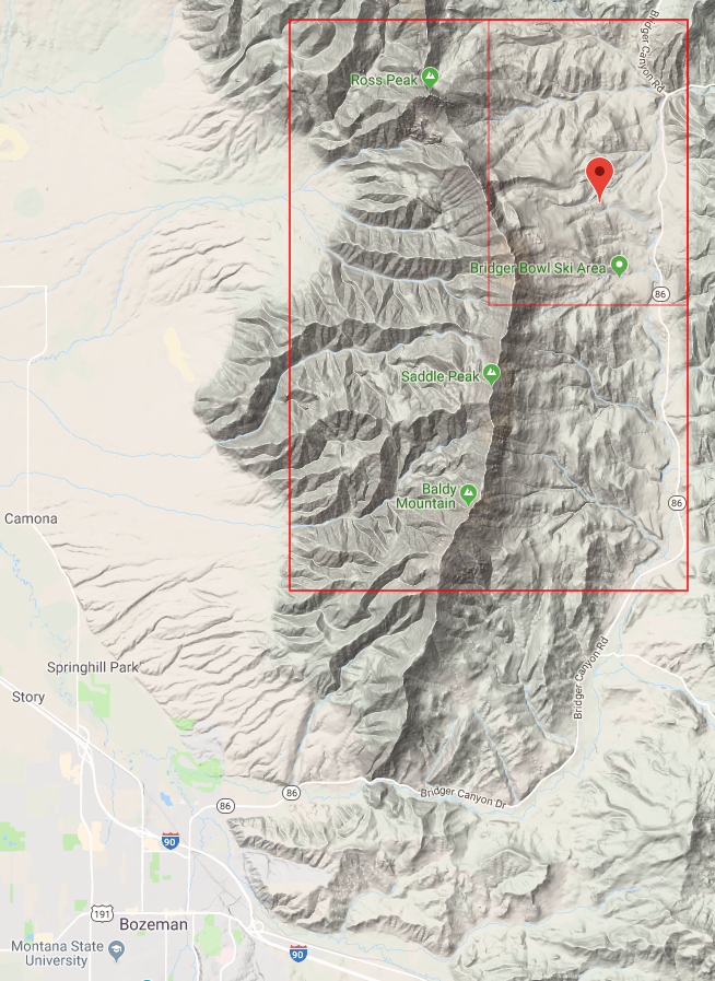
The proposed Keller mine and crushing facility and other operations in the area … create the possibility of reducing the attractiveness of home sites to potential homebuyers seeking a quiet, rural/residential type of living environment. These operations could also affect the marketability of existing homes, and therefore cause a reduction in the number of interested buyers and may reduce the number of offers on properties for sale. This reduction in property turnover could lead to a loss in realtors’ fees, but should not have any long-term effect on taxable value of property. …

Never mind slaves to defunct economists, DEQ hasn’t even figured out supply and demand.

When GOMAG (a local action group responding to an explosion of gravel mining applications) pointed me to these citations, I took a look at the Rygg Study. At the time, I was working on the RLI, and well versed in property valuation methods. What I found was not pretty. I’m sure the study was executed with the best of intentions, but it uses methods that are better suited to issuing a loan in a bubble runup than to measuring anything of import. In my review I found the following:

’¢ The Rygg study contains multiple technical problems that preclude its use as a valid measurement of property value effects, including:

o The method of selection of comparable properties is not documented and is subject to selection bias, exacerbated by the small sample
o The study neglects adverse economic impacts from land that remains undeveloped
o The measure of value used by the study, price per square foot, is incomplete and yields results that are contradicted by absolute prices
o Valuation adjustments are not fully documented and appear to be ad hoc
o The study does not use accepted statistical methods or make any reference to the uncertainty in conclusions
o Prices are not adjusted for broad market appreciation or inflation, though it spans considerable time
o The study does not properly account for the history of operation of the pit

’¢ The Fairbanks review fails to consider the technical content of the Rygg study in any detail, and adds general conclusions that are unsupported by the Rygg study, data, original analysis, or citation.
’¢ Citations of the Rygg study and the Fairbanks review in environmental assessments improperly exaggerate and generalize from its conclusions.

I submitted my findings to DEQ in a long memo, during the public comment period on two gravel applications. You’d think that, in a rational world, it would provoke one of two reactions: “oops, we’d better quit citing that rubbish” or, “the review is incorrect, and Rygg is actually valid, for the following technical reasons ….”  Instead, DEQ writes,

The Rygg report is not outdated. It is factual data. The Diane Hite 2006 report upon which several of the other studies were based, used 10 year old data from the mid-1990’s. Many things, often temporary, affect property sale prices.

Huh? They’ve neatly tackled a strawdog (“outdated”) while sidestepping all of the substantive issues. What exactly does “factual data” mean anyway? It seems that DEQ is even confused about the difference between data and analysis. Nevertheless, they are happy to proceed with a recitation of Rygg and Fairbanks, in support of a finding of no “irreversible or irretrievable commitments of resources related to the area’s social and economic circumstances.”

So much for the watchdog. Where DEQ ought to be defending citizens’ constitutional rights, it seems bent on sticking its head in the sand. Its attempts to refute the common sense idea, that no one wants to live next to a gravel pit, with not-even-statistical sleight of hand grow more grotesque with each EA. I find this behavior baffling. DEQ is always quick to point out that they don’t have statutory authority to consider property values when reviewing applications, so why can’t they at least conduct an honest discussion of economic impacts? Do they feel honor-bound to defend a study they’ve cited for a decade? Are they afraid the legislature will cut off their head if they stick their neck out? Are they just chicken?

Can Montana Escape Recession Ravages?

The answer is evidently now “no”, but until recently the UofM’s Bureau of Business and Economic Research director Patrick Barkey thought so:

“As early as last summer we still thought Montana would escape this recession,” he said. “We knew the national economic climate was uncertain, but Montana had been doing pretty well in the previous two recessions. We now know this is a global recession, and it is a more severe recession, and it’s a recession that’s not going to leave Montana unscathed.”

Indeed, things aren’t as bad here as they are in a lot of other places – yet. Compare our housing prices to Florida’s:

MT vs FL house price indexes

On the other hand, our overall economic situation shows a bigger hit than some places with hard-hit housing markets. Here’s the Fed’s coincident index vs. California:

MT coincident index of economic activity

As one would expect, the construction and resource sectors are particularly hard hit by the double-whammy of housing bubble and commodity price collapse. In spite of home prices that seem to have held steady so far, new home construction has fallen dramatically:

MT housing

Interestingly, that hasn’t hit construction employment as hard as one would expect. Mining and resources employment has taken a similar hit, though you can hardly see it here because the industry is comparatively small (so why is its influence on MT politics comparatively large?).

MT construction & mining employment

So, where’s the bottom? For metro home prices nationwide, futures markets think it’s 10 to 20% below today, some time around the end of 2010. If the recession turns into a depression, that’s probably too rosy, and it’s hard to see how Montana could escape the contagion. But the impact will certainly vary regionally. The answer for Montana likely depends a lot on two factors: how bubbly was our housing market, and how recession-resistant is our mix of economic activity?

On the first point, here’s the Montana housing market (black diamonds), compared to the other 49 states and DC:

State home price index vs 2000

Prices above are normalized to 2000 levels, using the OFHEO index of conforming loan sales (which is not entirely representative – read on). At the end of 2003, Montana ranked 20th in appreciation from 2000. At the end of 2008, MT was 8th. Does the rise mean that we’re holding strong on fundamentals while others collapse? Or just that we’re a bunch of hicks, last to hear that the party’s over? Hard to say.

It’s perhaps a little easier to separate fundamentals from enthusiasm by looking at prices in absolute terms. Here, I’ve used the Census Bureau’s 2000 median home prices to translate the OFHEO index into $ terms:

State median home prices

Among its western region peers, a few other large states, and random states I like, Montana starts to look like a relative bargain still. The real question then is whether demographic trends (latte cowboys like me moving in) can buoy the market against an outgoing tide. I suspect that we’ll fare reasonably well in the long run, but suffer a significant undershoot in the near term.

The OFHEO indices above are a little puzzling, in that so many states seem to be just now, or not yet, peaking. For comparison, here are the 20 metro areas in the CSI index (lines), together with Gallatin County’s median prices (bars):

Gallatin County & CSI metro home prices

These more representative indices still show Montana holding up comparatively well, but with Gallatin County peaking in 2006. I suspect that the OFHEO index is a biased picture of the wider market, due to its exclusion of nonconforming loans, and that this is a truer picture.

Rising at the Interest Rate?

With oil back at $70, I got curious how Hotelling is holding up. The observation that resource prices ought to rise at the interest rate is looking almost plausible now, if you squint, whereas it looked rather foolish for most of the 80s and 90s. Of course, the actual production trajectory has nothing to do with Hotelling’s simple model, which produces a monotonic decline. The basic problem with Hotelling, as I see it, is that there’s a difference between equilibrium and expectations subject to uncertainty. Moreover the extraction trajectory is largely controlled by the rate at which governments lease or otherwise exploit resources, and governments have more than the usual dose of bounded rationality. (I got interested in this because I’ve been investigating Montana’s management of mineral rights on its school trust lands. So far, the state’s exercise of its fiduciary responsibility looks suspiciously like a corporate welfare program. More on that another time.)

Oil vs Interest Rates

The figure compares the nominal oil price trajectory to actual risk-free rates (3month T-bills and the federal funds rate), as well as three constant rates for good measure. At those rates, one would have to conclude that a large risk premium must apply to oil production, or that there’s been an awful lot of uneconomic production over the years (for example, everything from about 1986 to 2006), or that current prices are just a blip and will continue to revert to some more moderate long-term level.

Flying South

A spruce budworm outbreak here has me worried about the long-term health of our forest, given that climate change is likely to substantially alter conditions here in Montana. The nightmare scenario is for temperatures to warm up without soil moisture keeping up, so that drought-weakened trees are easily ravaged by budworm and other pests, unchecked by the good hard cold you can usually count on here at some point in January, with dead stands ultimately burning before a graceful succession of species can take place. The big questions, then, are what’s the risk, how to see it coming, and how to adapt.

To get a look at the risk, I downloaded some GCM results from the CMIP3 archive. These are huge files, and unfortunately not very informative about local conditions because the global grids simply aren’t fine enough to resolve local features. I’ve been watching for some time for a study to cover my region, and at last there are some preliminary results from Eric Salathé at University of Washington. Regional climate modeling is still an uncertain business, but the results are probably as close as one can come to a peek at the future.

The future is generally warmer. Here’s the regional temperature trend for my grid point, using the ECHAM5 model (downscaled) for the 20th century (blue) and IPCC A2 forcings (red), reported as middle-of-the-road warming:

Bozeman temperature trend, ECHAM5 20c + A2

Continue reading “Flying South”