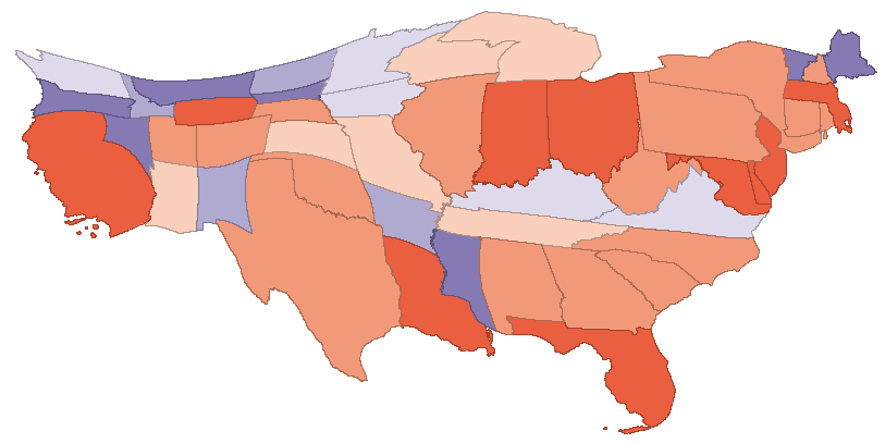
Nature had a nice article on a new tool that uses a diffusion algorithm to produce cartograms, maps rescaled in proportion to spatial variables. I know a bit about diffusion algorithms for image processing, and I can’t resist cool, free GIS software, so I downloaded a copy of the tool, ScapeToad, and tried it myself. First I grabbed a shapefile for US states from the Census’ TIGER/Line product. I clipped that to just the lower 48 states, using MapWindow. Also in MapWindow, I added a column to the shapefile’s attribute table to contain state emissions. In Excel, I used a lookup to insert state emissions from the Vulcan project into my emissions column in the attribute dbf. After a minute or two of chugging in ScapeToad (much more if you want higher resolution), I had this cartogram of state CO2 emissions: